Girard Interchange exchange

May 8
By Matt Blanchard
For PlanPhilly
If and when Sugarhouse arrives, PennDot says it will be ready with new, temporary I-95 ramps to handle the predicted flood of casino traffic.
Rather than wait the ten years it will take to reconstruct the entire Girard Avenue interchange, PennDot will install temporary ramps meant to help keep casino traffic off neighborhood streets. The temporary ramps are scheduled to open in spring 2010, just in time for Sugarhouse’s opening that summer.
“With all of the planned waterfront development – condos, casinos, et cetera – we were asked to advance a part of the construction work,” said Mark Rhoads, an engineering consultant with URS Corp.
Some 80% of casino traffic is expected to come from I-95 at the Girard Interchange. The final design — a concrete knot of new ramps and roads – won’t be finished until 2017.
One temporary ramp will allow southbound 95 traffic to get directly onto Aramingo Avenue, and from there to Delaware Avenue. It’s a major improvement over the current ramp which dumps cars onto Girard, forcing drivers to filter through residential streets on their way to the waterfront.
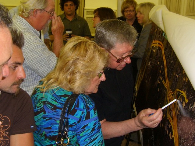
Rhoads spoke at a meeting of the Fishtown Area Business Association, where the engineer swooped and crossed his arms in an effort to illustrate the complex set of connections between the interstate and Girard, Aramingo, Delaware and Richmond Avenues.
“It’s like trying to describe a bowl of spaghetti,” remarked community activist Joe McNulty. Several key points, however, were clear:
Cramps Building to get the Axe
The last remaining part of the once-famous Cramps Shipyard is still stated for obliteration. In its place, an off-ramp from 95 North will swoop down to meet an on-ramp at a brand new intersection.
The Cramps Building is a square-shouldered former machine shop with huge banks of windows, standing with its back to I-95 at the corner of North Delaware Avenue and Dyott Street.
In May 2006, the owners floated a plan to convert the structure into condominiums, but PennDot has said saving the building would require the highway expansion to go west into neighborhoods rather than east towards the river.
PennDot is right now buying-up such properties for demolition, according to the agency’s Elaine Elbich. But by law, she said she can’t give specifics: “I can’t tell you whether I’m taking a building or not, but you can look at the footprint of the highway and guess.”
The maps were clear: Cramps gets the axe.
That was a surprise to Cheryl Hodolitz, who studied the map and came away scratching her head: “My business is moving into that building in two weeks,” she said.
Noise and Pollution
There will be both noise and pollution as the project moves forward, though there may be good news on the noise.
According to Elbich, PennDot is anticipating the construction of noise walls to screen construction from the neighborhoods. While no decision has been made, Elbich said it’s likely the community will be consulted on textures and treatments of these walls.
On pollution, Northern Liberties activist Hilary Regan called PennDot’s pollution studies inadequate, and questioned whether the entire project was justified.
“You know what happened when 95 was shut down for the pier collapse?” Regan asked. “There was traffic for about a day and then it was fine, because everyone started taking the train.”
PennDot officials didn’t attempt to answer the big question, but did say the road, which handles 180,000 cars a day, is expected to be handling 225,000 by 2030 – ergo it must be good for something.
But Regan does have a little history on her side: Both San Francisco and Portland blew up waterfront highways and saw mysteriously little traffic impact from the move.
Pedestrian Underbelly
Finally, PennDot promises a kinder, gentler underbelly for the new maze of ramps. Right now, the mess of the Girard Interchange creates a 7-block wide barrier separating Fishtown pedestrians on the west of the highway from the waterfront to the east.
PennDot is working with PennPraxis and the City Planning Department to connect east and west under the road, with possibilities for green space, eco-sensitive stormwater handling, and a bike-walk path along Aramingo Avenue.
Contact the reporter at blanchard.matt@gmail.com
WHYY is your source for fact-based, in-depth journalism and information. As a nonprofit organization, we rely on financial support from readers like you. Please give today.


