Streetsplainer: What to do in an emergency on the Schuylkill River Trail?
Welcome to Streetsplainers, an occasional series of answers to those often overlooked questions about our beleaguered/beloved transportation systems: Just what the heck is that thing in the road? Why on Earth would SEPTA do that? How does that weird doohickey work? E-mail Jim your questions, and he’ll chase down the answers, hopefully in a reliably on-time fashion.
Reports of assaults along the Schuylkill River Trail and social media accounts of 911 dispatchers who did not know what callers meant by “Schuylkill River Trail”, have left some users worried that the award-winning pedestrian and bicycle path isn’t safe. So, how safe is the trail and what should you do in case of an emergency there?
While assault and harassment are nothing we should tolerate as a society or take lightly as a city, it is worth noting here that the trail is no more dangerous than other parts of Philadelphia.
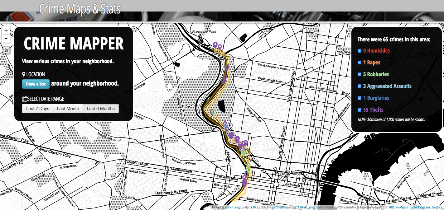
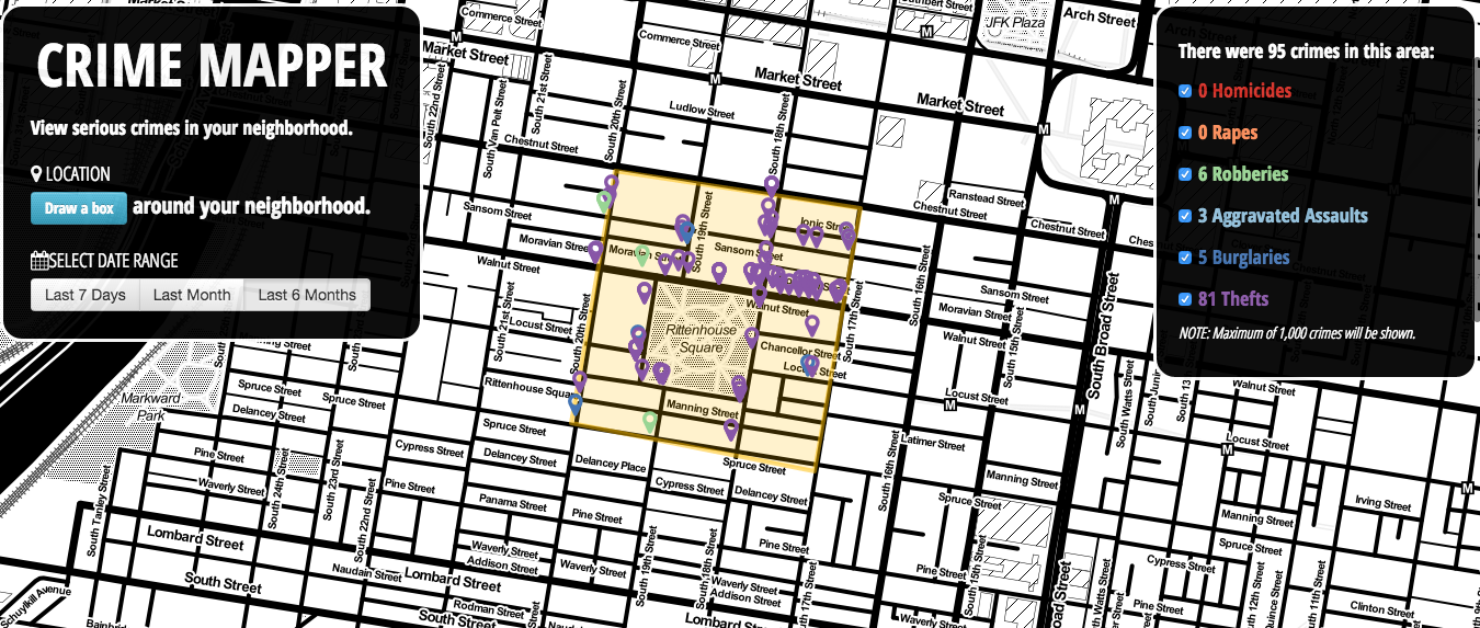
The maps below, from the Philadelphia Police Department’s Crime Mapper, show incidents of major crimes along the Schuylkill River Trail and around Rittenhouse Square over the last 6 months. There were 55 thefts, 3 aggravated assaults, 5 robberies and one rape on the trail during that period. A robbery is a theft by force or threat of force – the report of a teenager shoving a woman in the process of stealing her bicycle would be classified as a robbery, for example, as would someone brandishing a gun while demanding your wallet.
Those figures are comparable to crime statistics in the area immediately surrounding Rittenhouse Square: 81 thefts, 3 aggravated assaults and 6 robberies over the same six-month period.
It should also be noted that most of the theft incidents along the Schuylkill River Trail were “theft from vehicle”, i.e. petty criminals breaking into parked cars to steal car stereos or valuable items left on the seats.
Now, Rittenhouse Square is packed with way more people than the trail, meaning there are more opportunities for criminal interactions. But it’s still fair to say that the trail is no more dangerous than our city’s fanciest park.
That being said, crimes do happen along the trail, as well as medical emergencies. In most parts of Philadelphia, you are never further than a few yards from a street corner, which can serve as a handy pair of coordinates when you call 911.
But that’s not the case along the Schuylkill River Trail, separated from cross streets by freight rail lines in Center City, and then along Kelly Drive’s largely uninterrupted path through Fairmount Park. The relative lack of landmarks can make reporting an accident to the authorities difficult.
While 911 systems are supposed to be able to use a combination of GPS and cell phone tower triangulation to pinpoint the location of a mobile phone, the technology doesn’t always work. And even when it does, it provides the location in the form of latitude and longitude. Some 911 call centers, such as those in Delaware County, automatically convert those coordinates into street locations, but not all do.
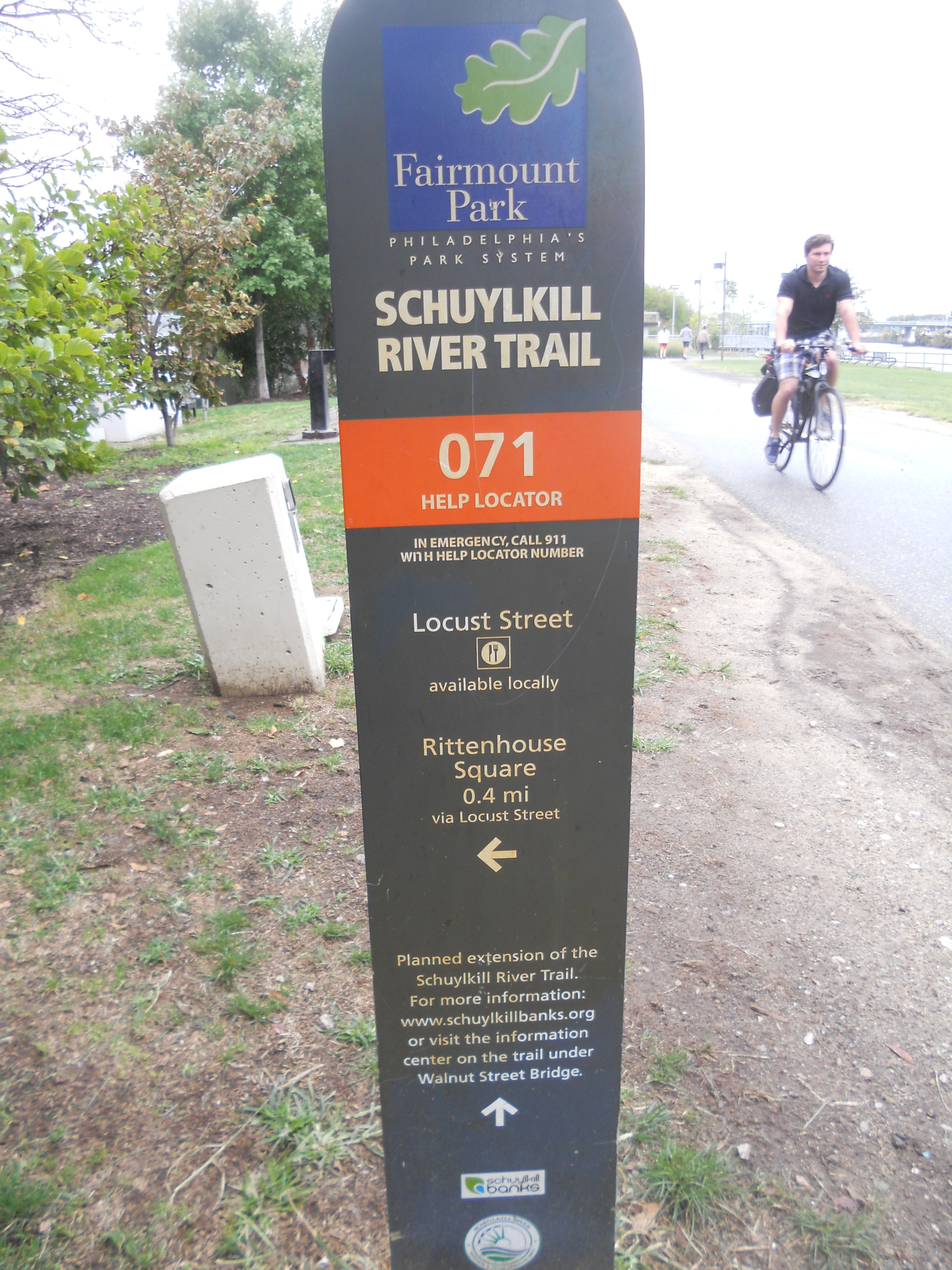
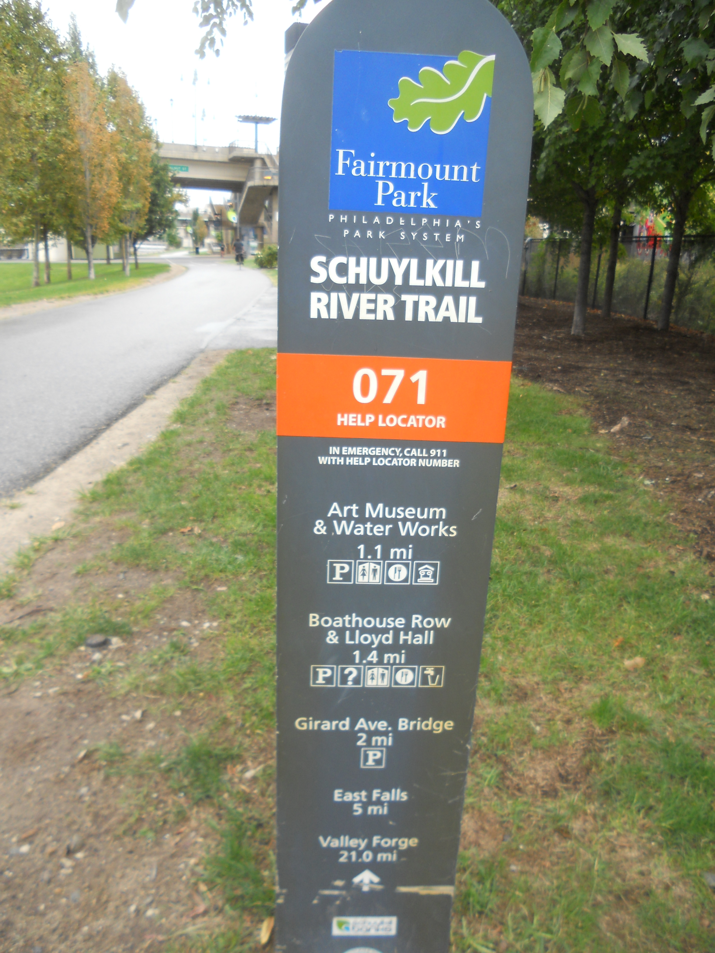
That’s why there are little ski-shaped little signs called “help locators” located along all 130 miles of the Schuylkill River Trail. If you call 911 and tell the dispatcher that you’re near “Help locator number 071 on the Schuylkill River Trail,” they should know exactly where that is and be able to guide first responders to you, regardless of the county, municipality or even police district you might be in.
Should.
“Usually the operator recognizes [the help locator number] and knows what that means,” Schuylkill River Development Corporation (SRDC) President Joseph Syrnick told PlanPhilly.
But: “There have been some locations where they have not.”
The SRDC only has limited control over the Schuylkill River Trail, and only along the Schuylkill Banks portion in Philadelphia. Throughout the city, it’s the Department of Parks and Recreation that’s in charge and as the trail leaves Philadelphia, each additional municipality controls its portion of the trail.
Syrnick supports installing more of the often-overlooked signs, which double as mile-markers along the trail. “If we put more of these signs up,” said Syrnick, “I think people will see them more frequently, and understand what they are.”
Just how overlooked are the signs?
So overlooked that I – someone who rides his bike on the trail on a near daily basis – didn’t realize they exist until after I asked Syrnick why there “aren’t there any mile markers on the trail.”
It gets worse. When PlanPhilly spoke with Syrnick, he said, “After [PlanPhilly contacted me for this story], I got a call from the 9th district police captain… asking us if there was a way for someone to put mile markers on the trail.”
After informing the captain about the help locators, Syrnick said, he promised to ensure that the police in his district would be familiar with the system.
PlanPhilly made multiple requests over a period of weeks to the Philadelphia Police Department to discuss the 911 dispatch system and the department’s response to reports of attacks on the Schuylkill River Trail. We were told that someone would contact us. No one did.
WHYY is your source for fact-based, in-depth journalism and information. As a nonprofit organization, we rely on financial support from readers like you. Please give today.


