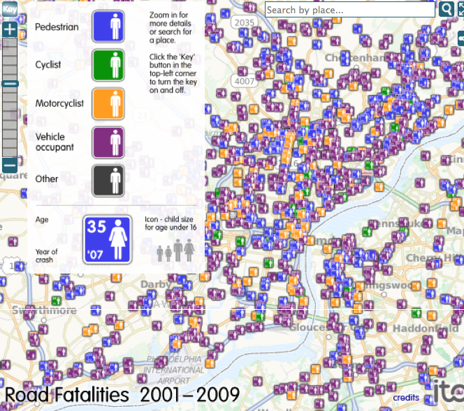
Deadly streets: mapping road fatalities

We talk a lot about creating complete streets and providing everyone – pedestrians, cyclists, and motorists – with safer spaces to move through the city. But where are Philly’s streets the most deadly and for whom?
ITO created a map of road fatalities in America from 2001-2009, allowing us to visualize a harrowing number of fatal accidents, using data from the Fatality Analysis Reporting System of the National Highway Traffic Safety Administration.
WHYY is your source for fact-based, in-depth journalism and information. As a nonprofit organization, we rely on financial support from readers like you. Please give today.


